
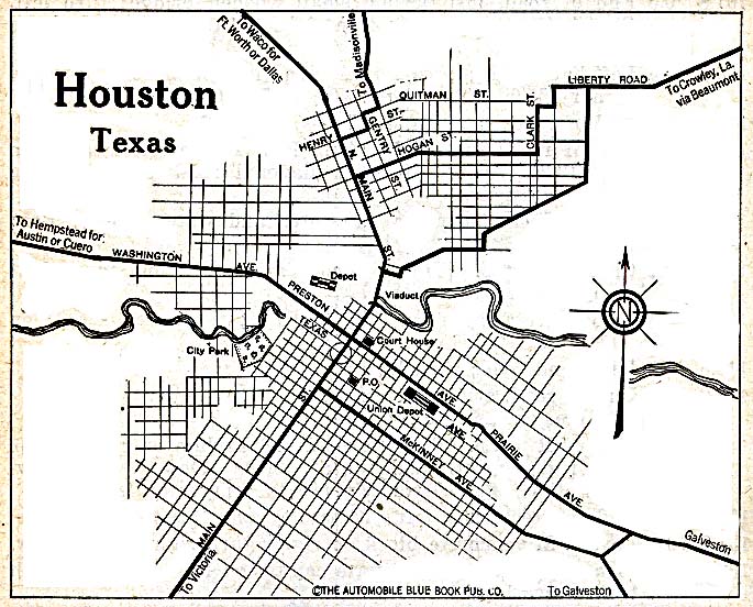
1869 – Street map of Houston
1873 – Panoramic map of Houston
1873 – Houston city plan
1890 – Street map of Houston
1891 – Panoramic map of Houston (copy 1)
1891 – Panoramic map of Houston (copy 2)
1891 – Panoramic map of Houston (copy 3)
1895 – Street map of Houston
1912 – Panoramic map of Houston
1913 – Street map of Houston
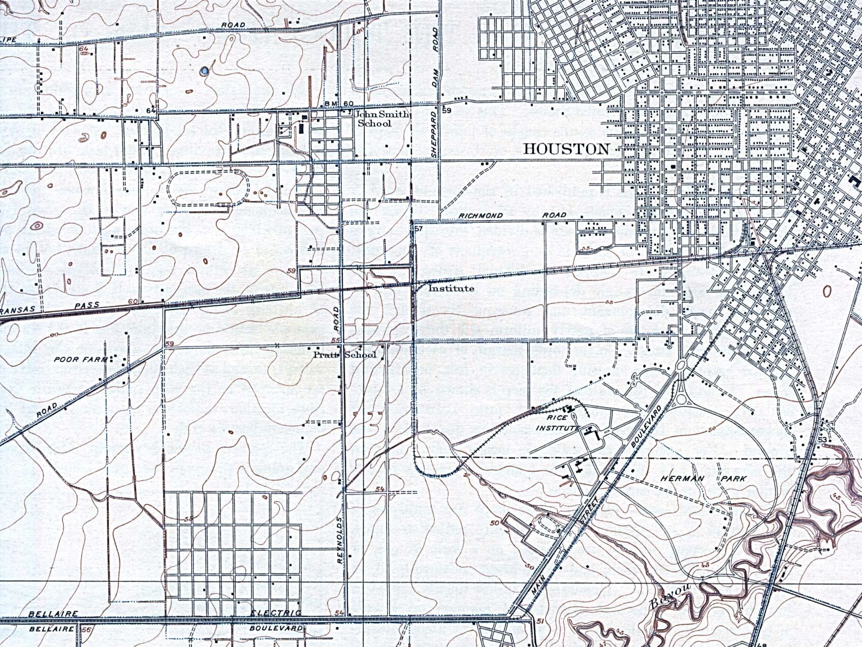
1915 – Topographic map of Houston (NW)
1915 – Topographic map of Houston (SW)
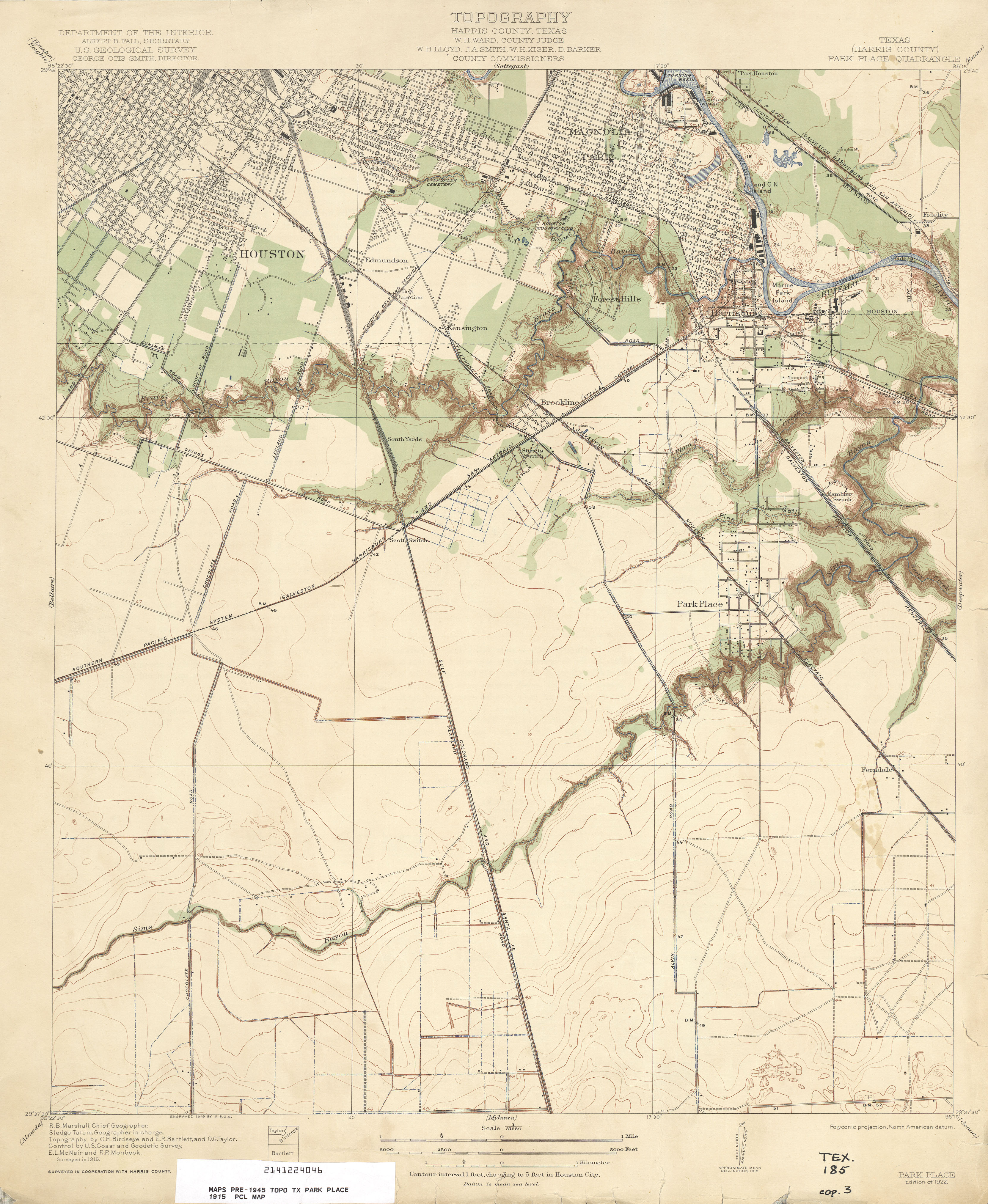
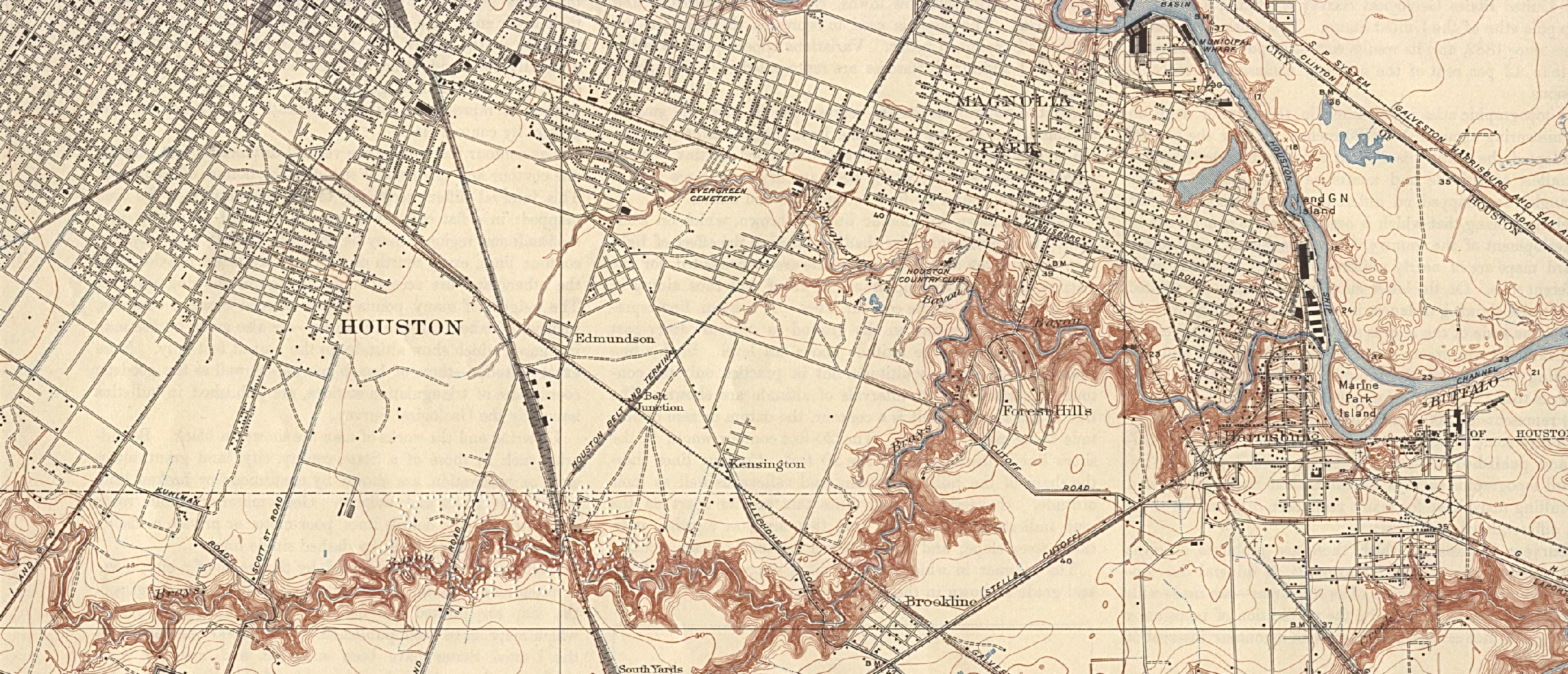
1915 – Topographic map of Houston (S)
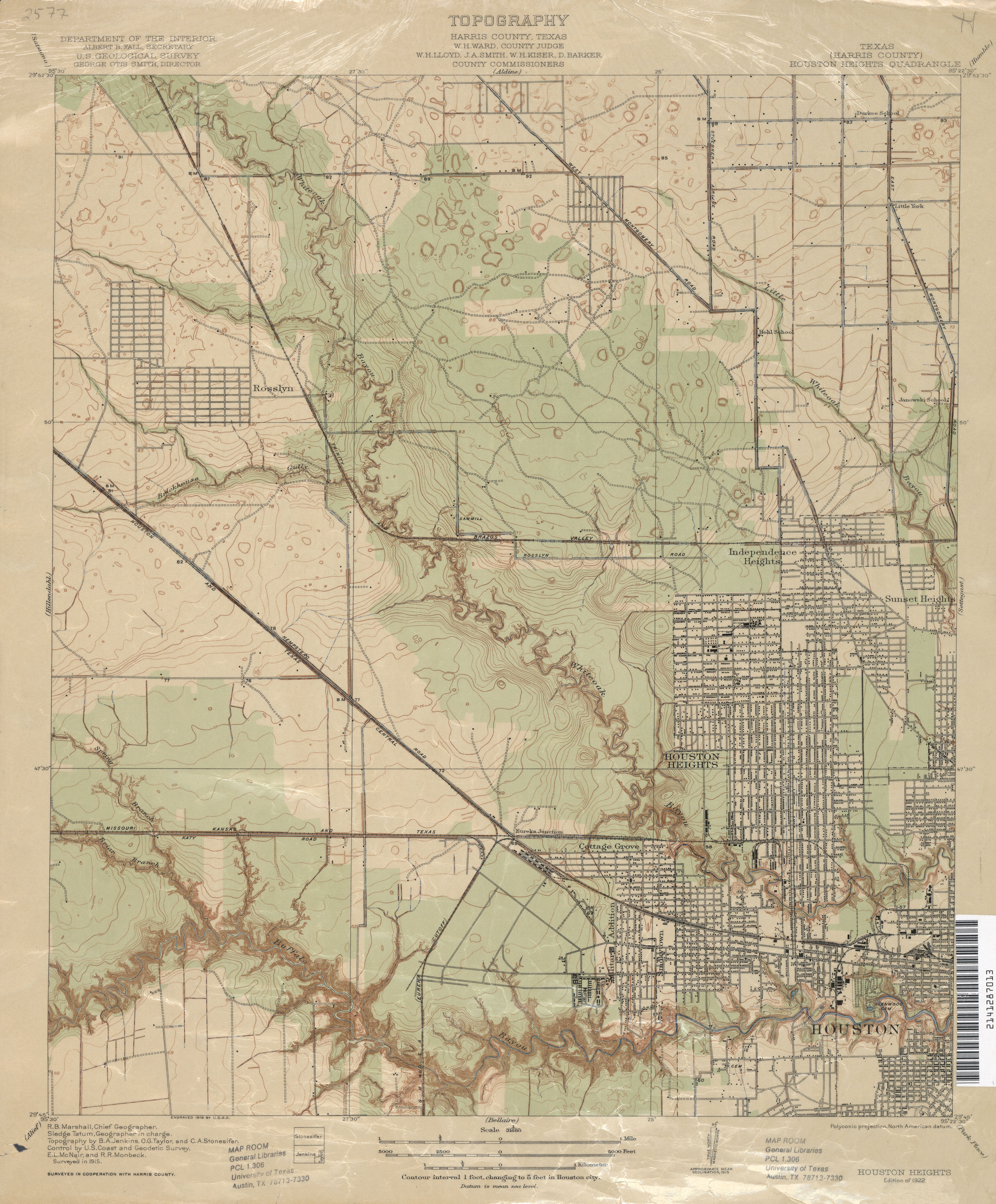
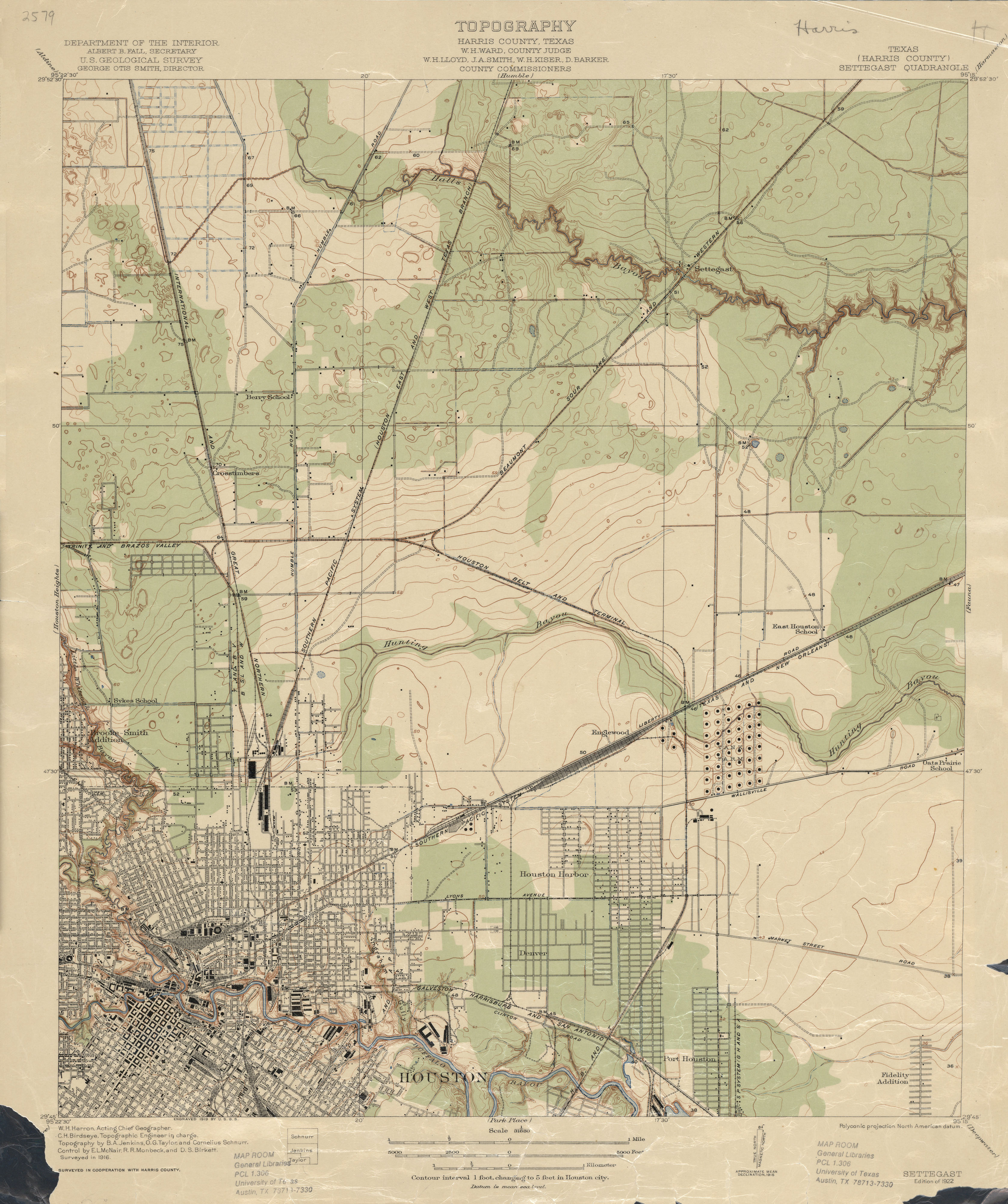
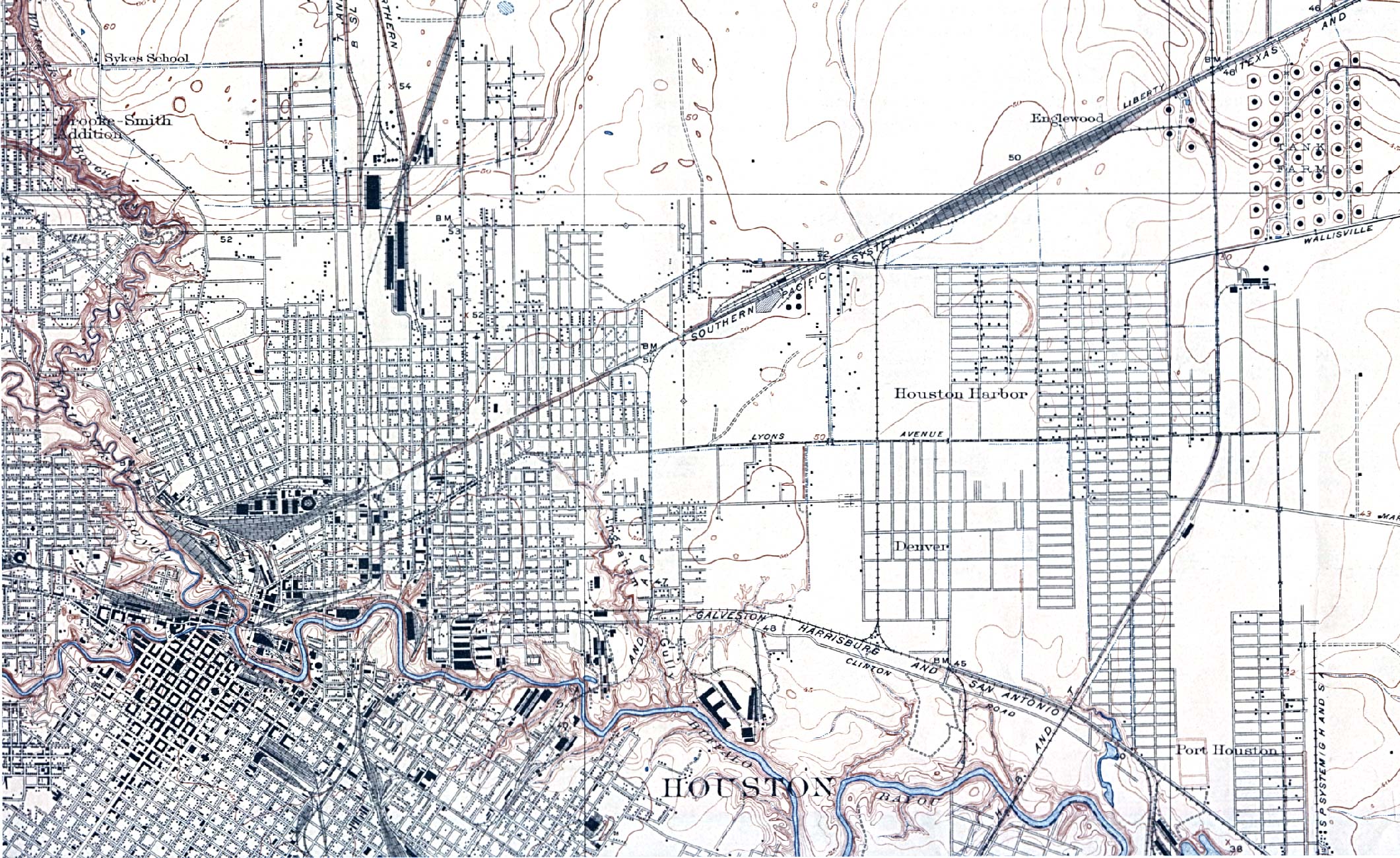
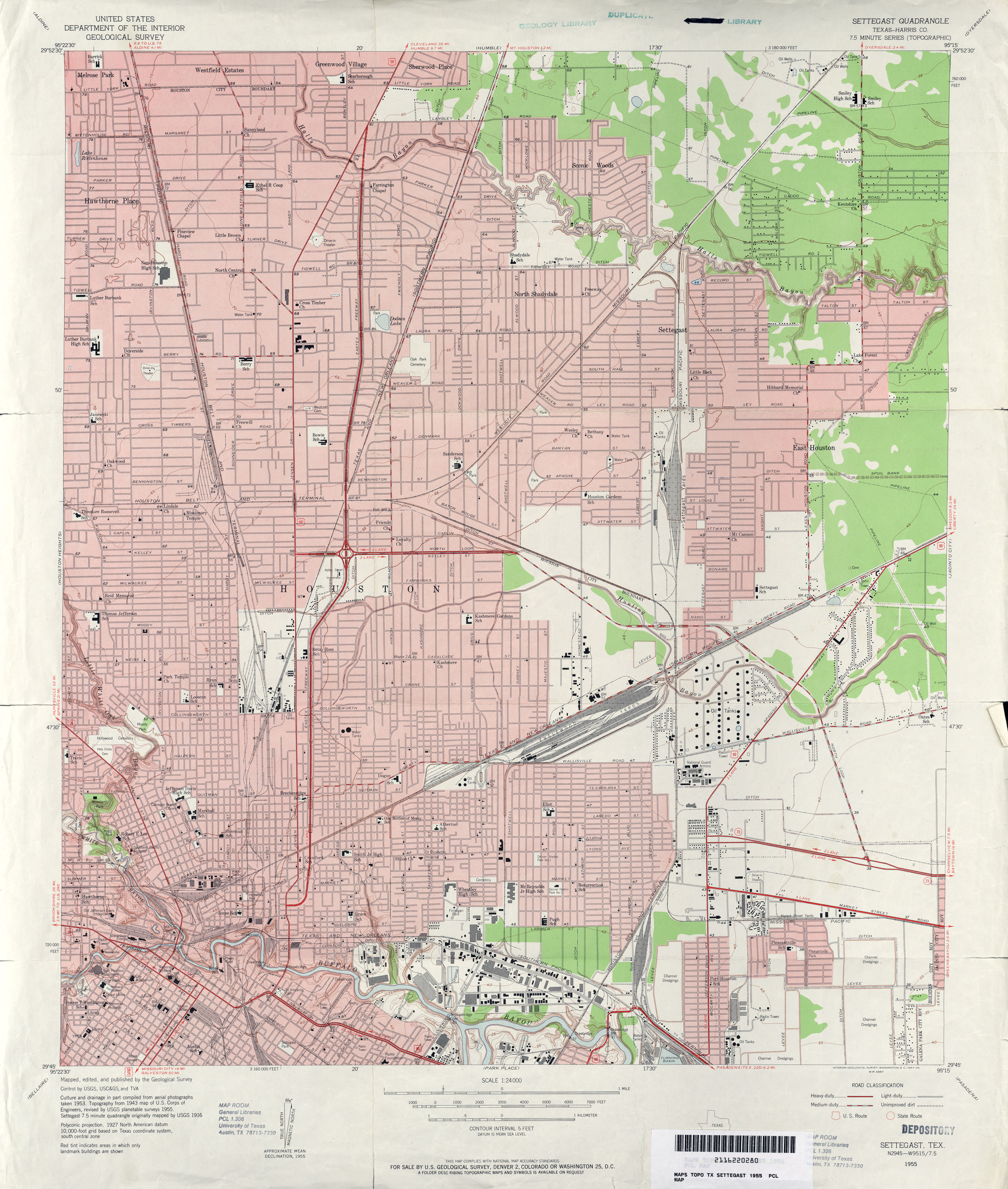
1916 – Topographic map of Houston (NE)
1920 – Street Map of Houston (showing wards)
1920 – Road map of Houston
1921 – Topographic map of Houston (SW)
1922 – Topographic map of Houston (NW)
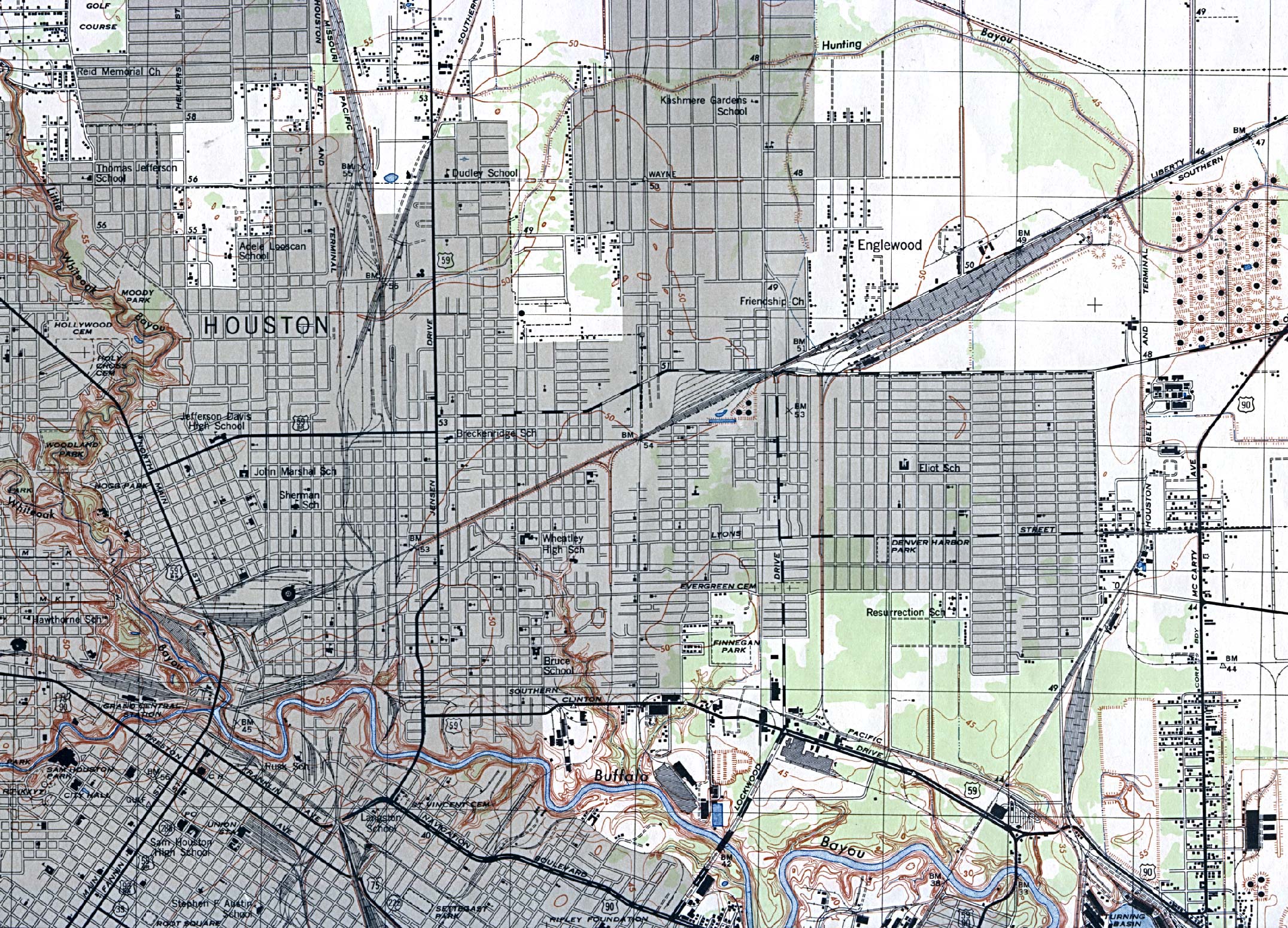
1922 – Topographic map of Houston (NE)
1932 – Topographic map of Houston (SE)
1935 – Road map of Houston
1937 – Street map of Houston
1939 – Railroad map of Houston (SW)
1942 – Houston road map
1942 – Street map of Houston (inc. proposed streets in red)
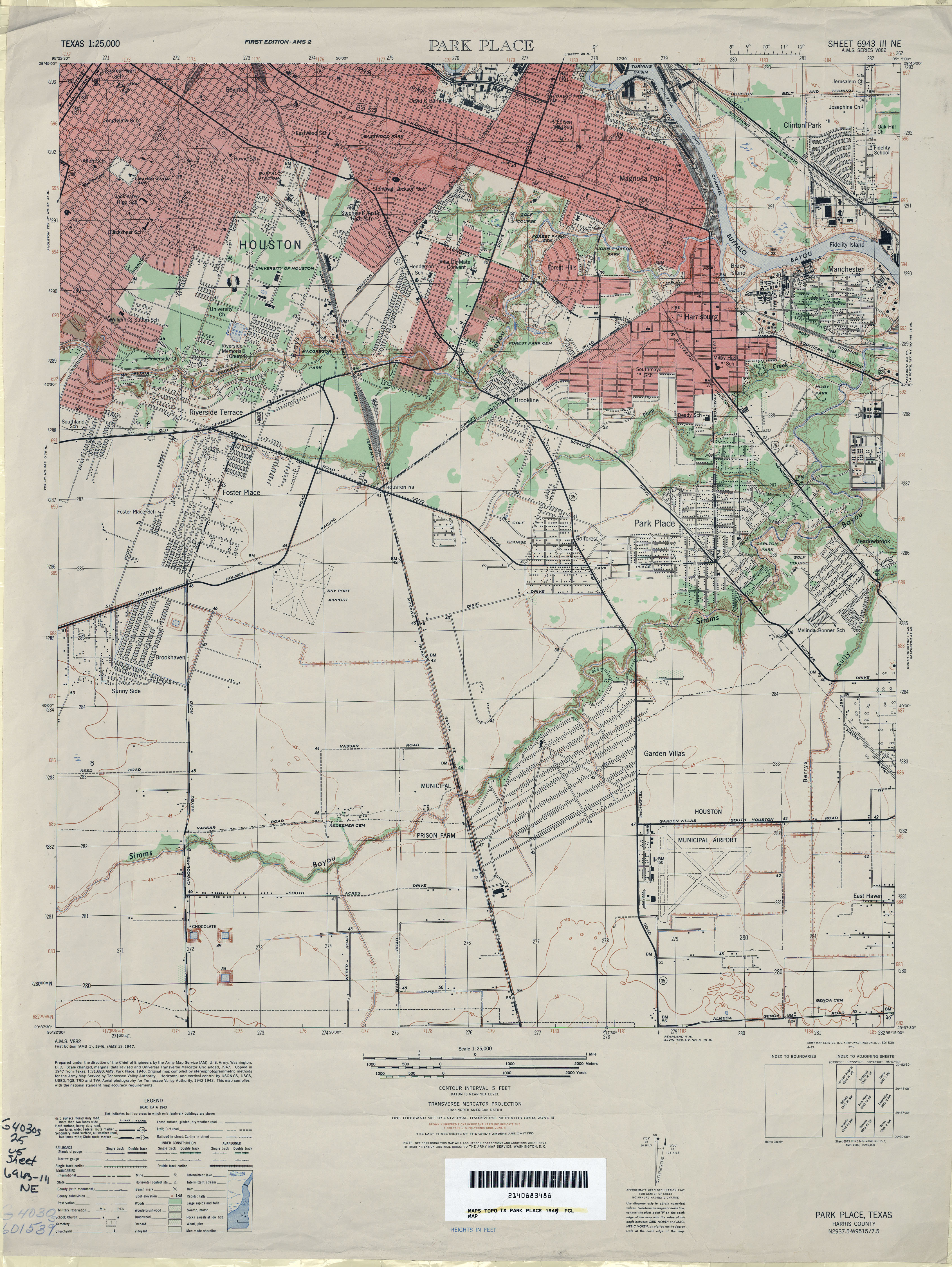
1946 – Topographic map of Houston (NE)
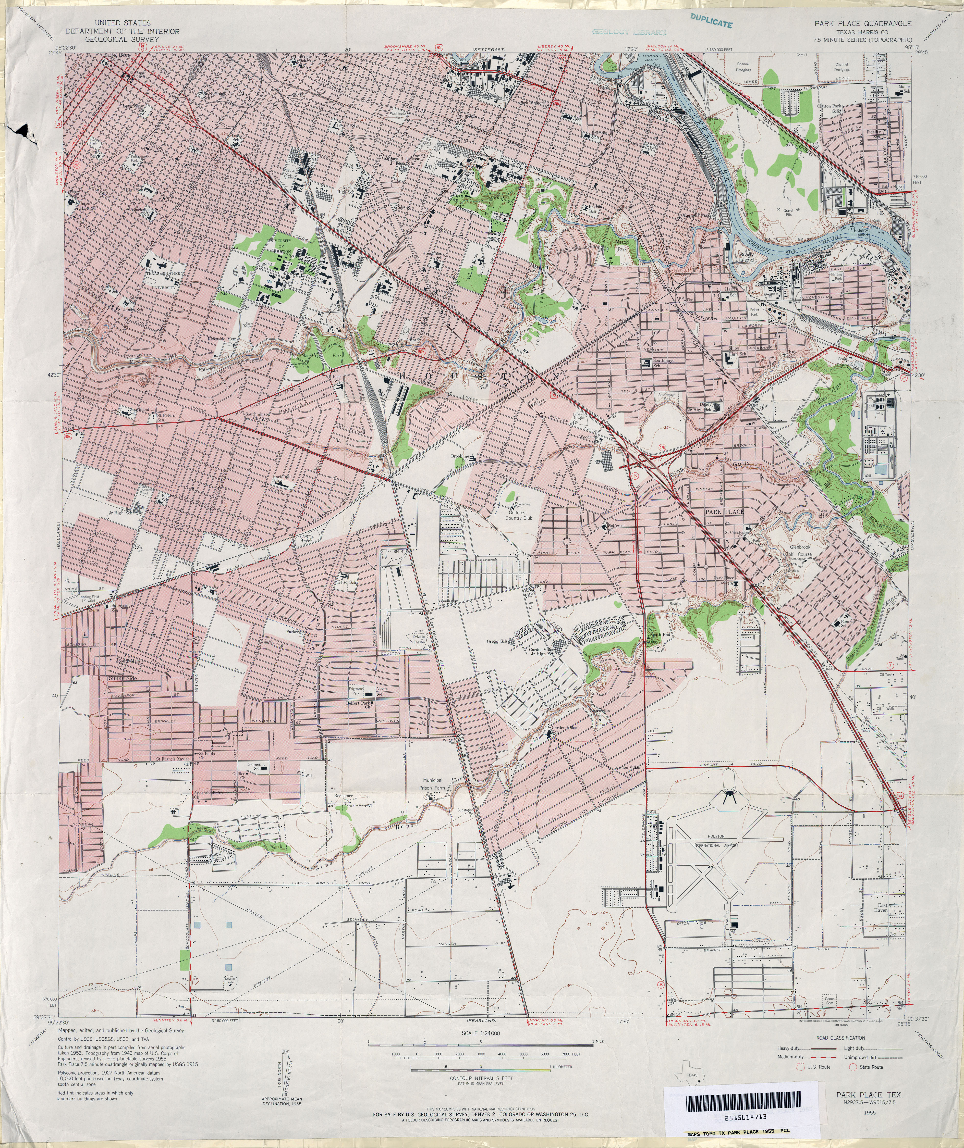
1947 – Topographic map of Houston (S)
1950 – Road map of Houston
1952 – Road map of Houston
1954 – Road map of Houston
1954 – Road map of Houston
1955 – Street/Topographic Map of Houston
1955 – Topographic map of Houston (NW)
1955 – Topographic map of Houston (S)
1955 – Topographic map of Houston (NE)
1955 – Road map of Houston
1956 – Road map of Houston
1957 – Historicaerials.com
1958 – Road map of Houston
1960 – Road map of Houston
1960 – Road map of Houston
1961 – Road map of Houston
1961 – Street map of Houston (NW)
1961 – Railroad and highway Map of Houston (W)
1962 – Road map of Houston
1964 – Historicaerials.com
1965 – Road map of Houston
1965 – Road map of Houston
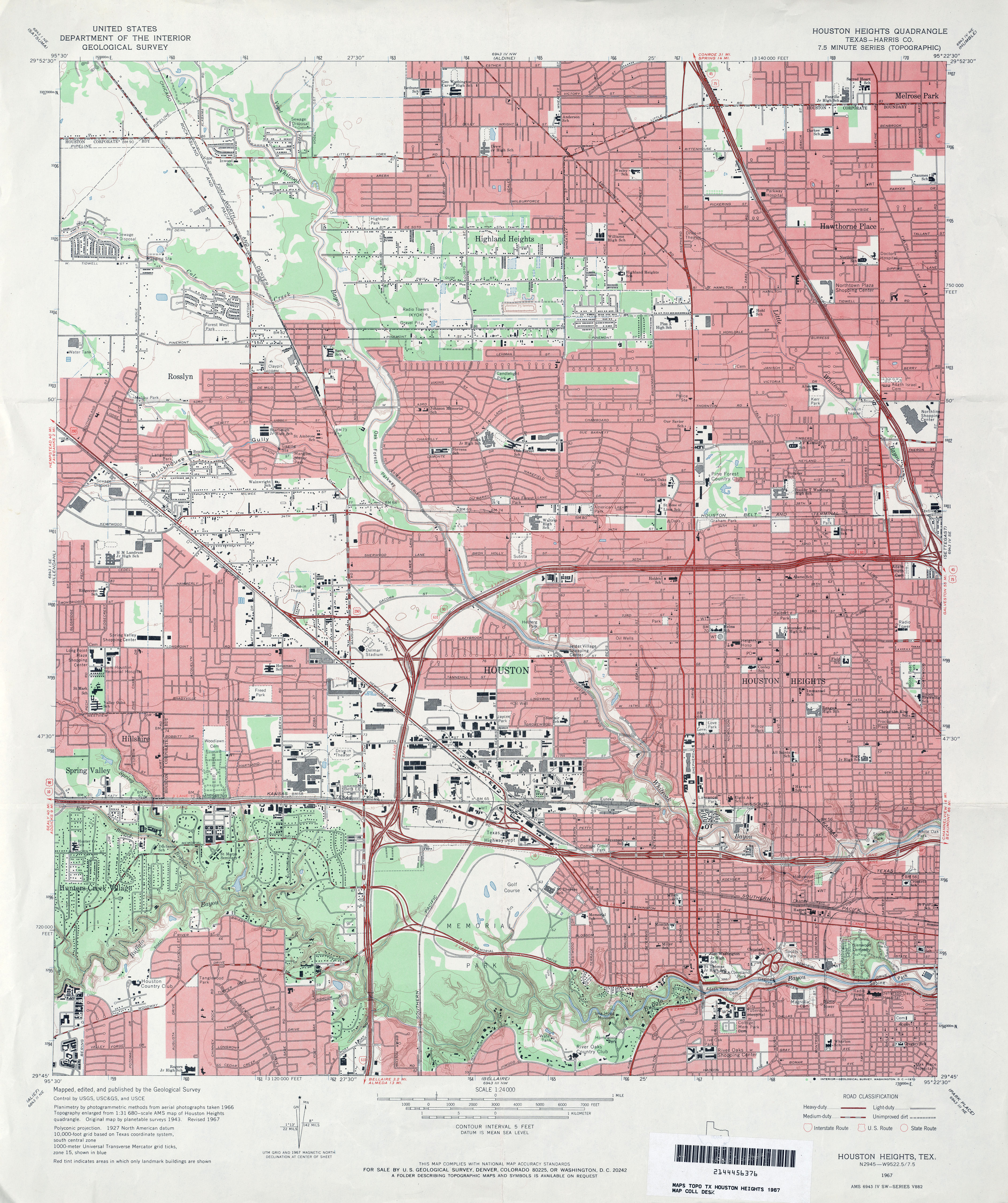
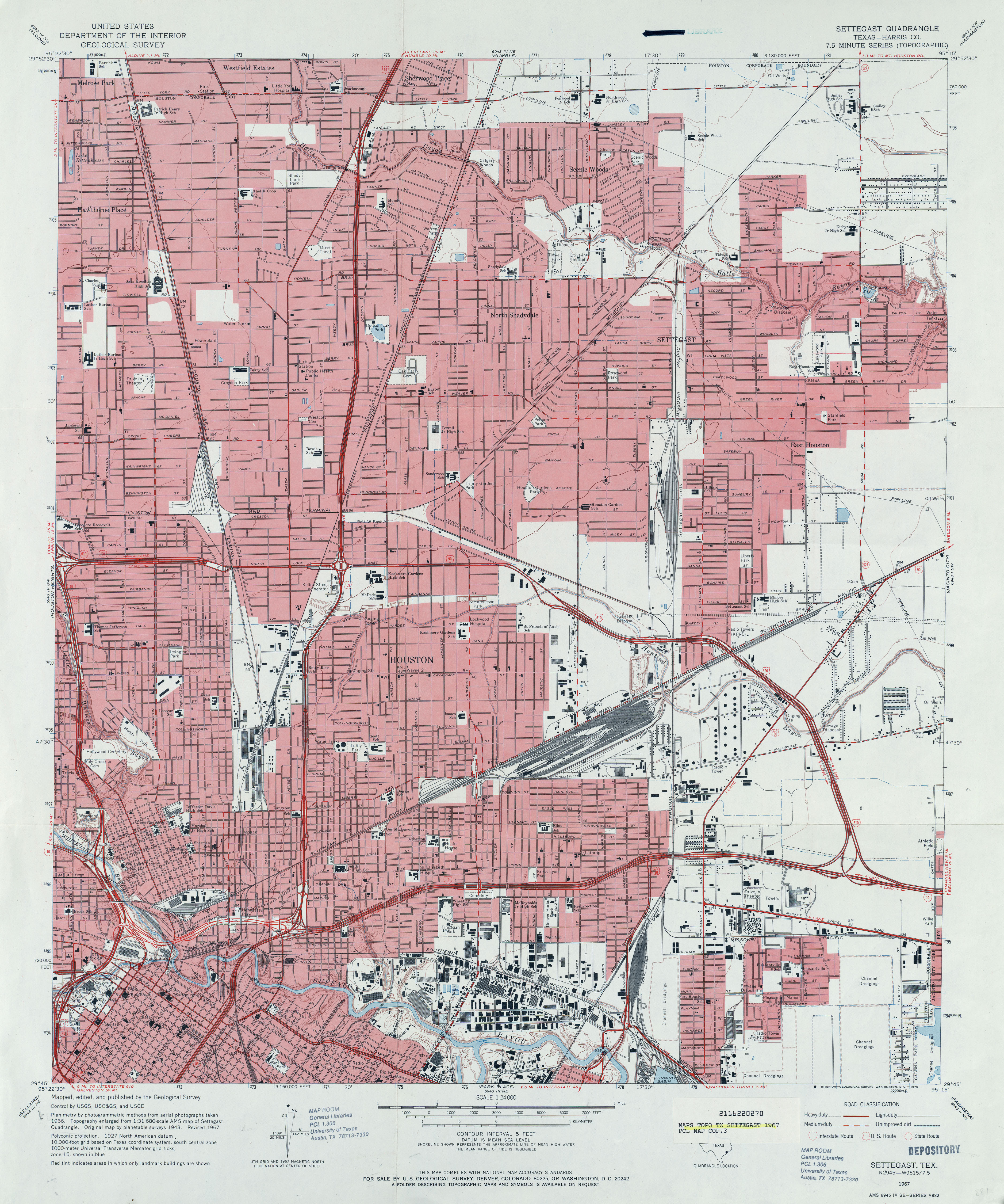
1967 – Topographic map of Houston (NW)
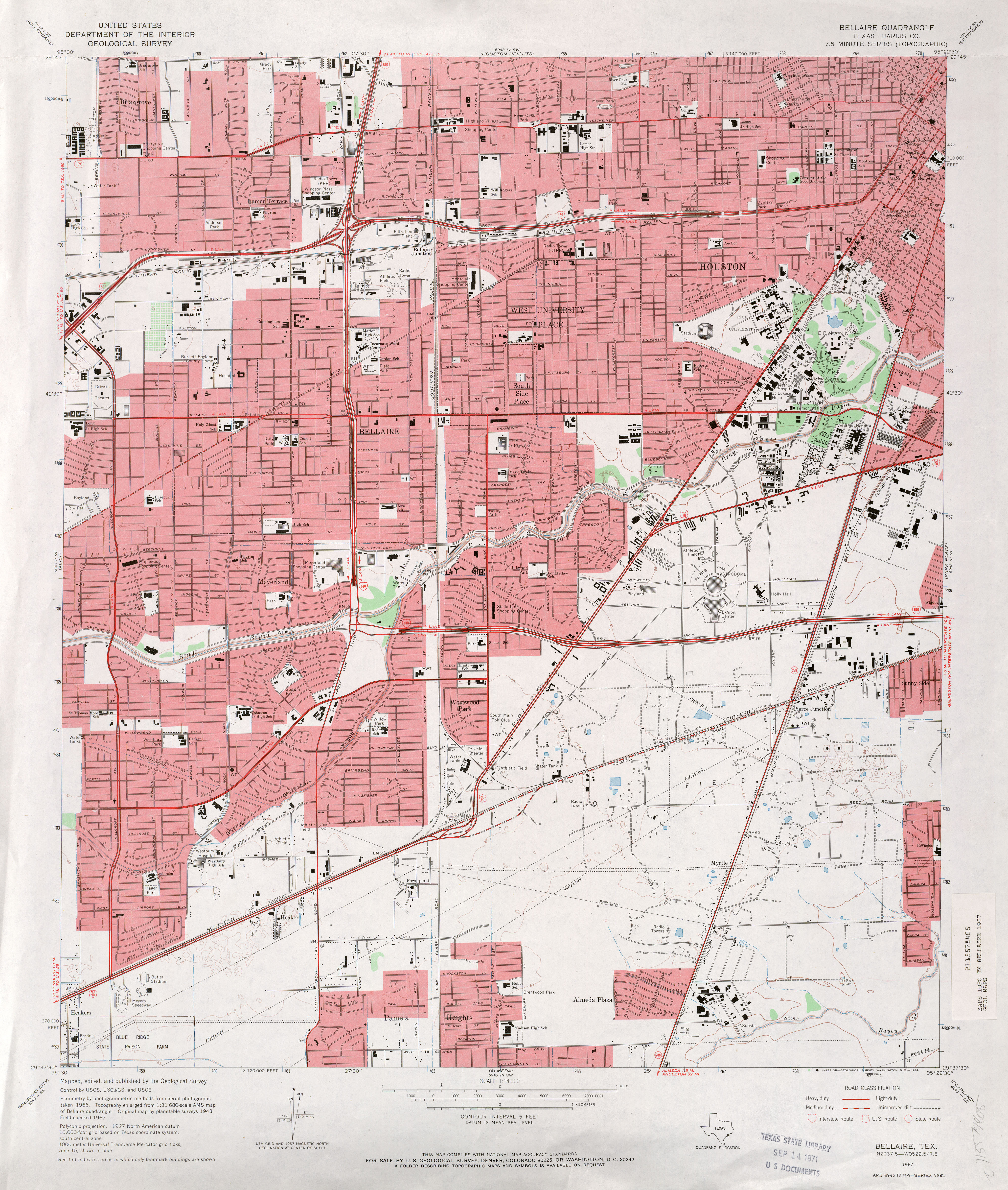
1967 – Topographic map of Houston (SW)
1967 – Topographic map of Houston (S)
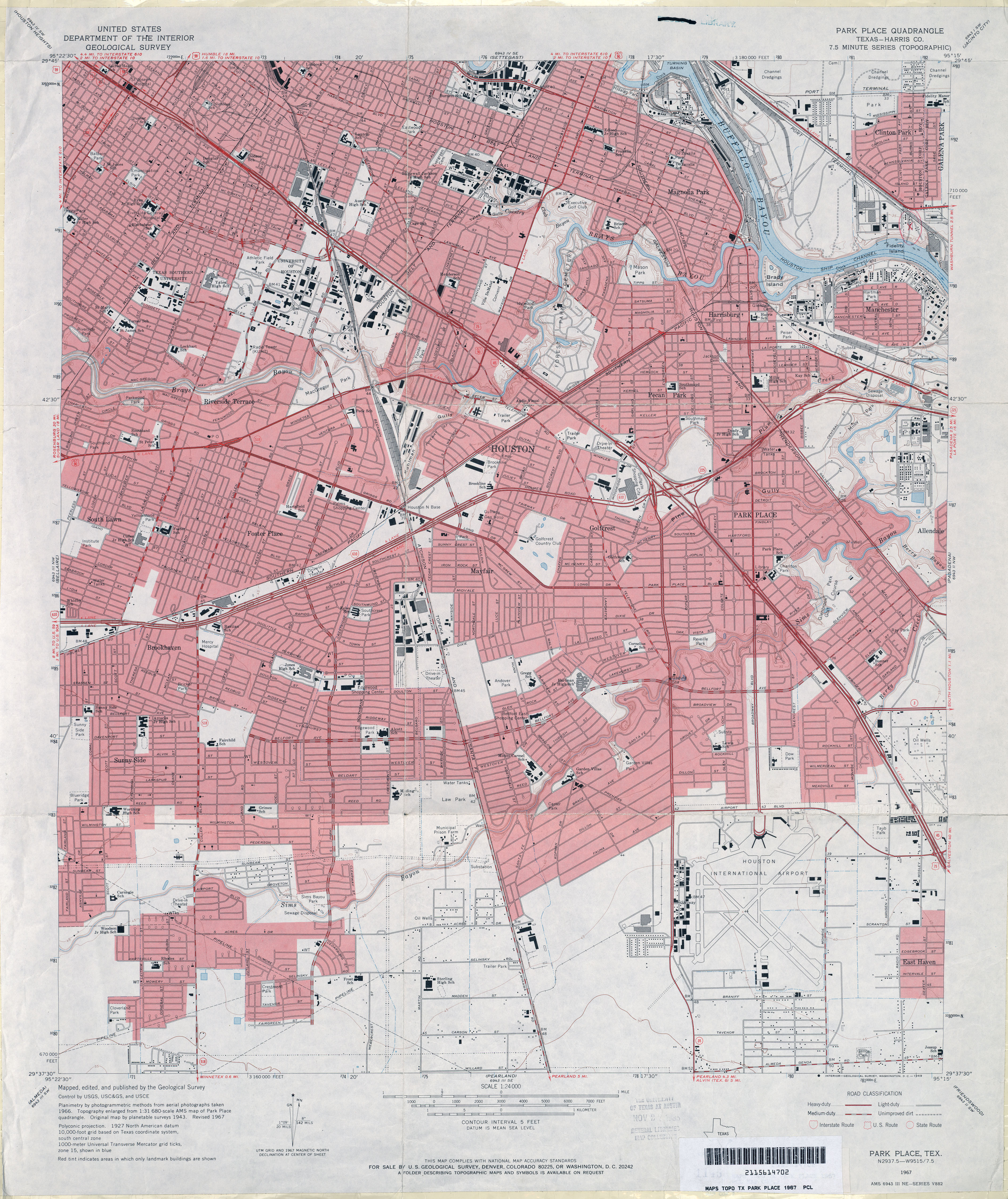
1967 – Topographic map of Houston (NE)
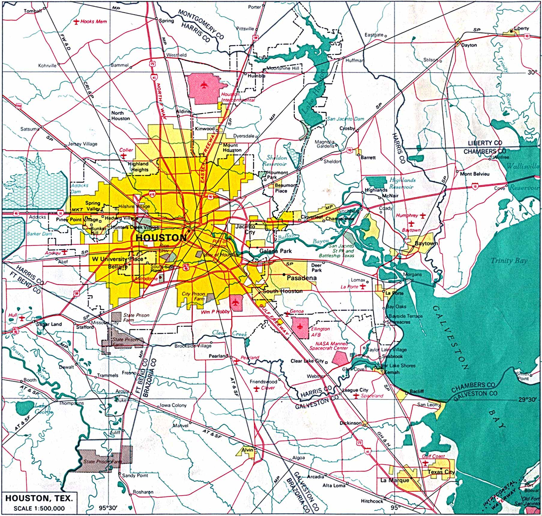
1967 – Road map of Houston
1968 – Road map of Houston
1970 – Road map of Houston
1970 – Road map of Houston
1972 – Road map of Houston
1973 – Historicaerials.com
1973 – Road map of Houston
Categories
Archives

Hello – I enjoy all the information you have here. I would like to point out that the maps you list as “Geologic” are actually “Topographic” maps.
Sincerely,
Cecil
Thanks, Cecil. I thought I had a good reason for labeling them the way I had. When I looked back, though, while I did have a reason, it was not a very good reason. So I’ve changed the labels.
Thanks again for your interest/assistance, and best regards.
Just wanted to let you know the link for 1915 – Topographic map of Houston (NW) is actually pointing to a 1947 topo:

Nice site!
Thanks, Jim! I think I’ve fixed it now.
Worked great, thanks.
Thank you so much for your help and reply, you have no idea how much this means to me.
Do you know any way I can find a framable print of a 1947 street map of Houston? I have searched the internet and can’t find one anywhere. Thanks so much for your help!
I’ve enjoyed the blog, but I do not find postings beyond mid-2009. Will they resume?
Thanks, Will. The lack of recent posts is due to a combination of about 10 different things, but is mostly due to a lack of time over the past year. But I do hope to get back in the habit of at least occasional posts soon. Appreciate the interest.
Pingback: History Lesson? Why are the streets numbered from I-10 to 610N? (heights) - Houston - Texas (TX) - City-Data Forum
I am looking for Roderick street. My grandmother lived there in the late 40’s and early 50’s. I remeber it was in the Heights and somewhere off Shepperd. My dad would take us to a park to ride the ponies. My mom still has a picture. Would love to go back to the area and look at it today. Could someone tell me where I need to look?
The Roderick street has been renamed Durham. It runs parallel to Shepherd Dr.
Thank you so much. Will be going to Houston soon to see grandchildren and will go by the old residence.
I am not a profit but on Shepard and around that time frame gotta be Sears, my gest, still there today 😎❤🎶.
Pingback: History Creates Fascinating Possibilities « The Pecan Park Eagle
Where is an old map of Pasadena streets in the middle 1950’s? I was curious about the street names in the old Maxwell homes edition or the Soutmore Heights edition, whichever they called it. I lived on Lola street when I was a child. Also I lived on Herbert St, I think. Both streets were in the same residential area bordered on two sides by Tatar and Harris streets. At the corner of these streets was a shopping center with a drug store, a Minimax, and Brown’s five and dime. Thank you. Gary Neill
Gary, did you ever get an answer to your question? I lived on Westfall Street in the middle ’50s and I do have a street map – somewhere LOL.
Hi Marie-No, I still haven’t found a really complete Pasadena street index yet. I cannot find the streets between Harris and Southmore. They were bordered on the east by Davis and the west by Tatar. I stopped looking for awhile. Got kind of discouraged, I guess. I attended Gardens Elementary (1957) and Jackson Jr. High (1959-1960) Thanks-Gary Neill garyn@skybeammail.com
Wow. I’ve been trying to remember the name of the drug store in the center with Minimax. Does anyone know the name?
My family and my aunt’s family lived in Maxwell Homes on East Lola about 1952. My aunt still lives in the general area. She said that the drug store near Minimax, as well as she could recall, was “Taylor’s.” Does that pharmacy name ring a bell with you, Shelly? She also said that the “mall” is where the neighborhood used to be. I recall the house a bit and our next door neighbors, Bertie/Birdie and E.M. and their daughter. I also can recall a bit of the way the houses looked. It was a duplex.
Does anyone know where you can purchase historical maps of Houston?
Pingback: Maps That May Be Of Use For Bug Out Routes, Caches, Bug Out Locations and Homestead Locations | Survive2, Home of The Guide To Living
Hi there, You have performed a great job. I will definitely digg it and personally recommend to my friends. I’m confident they will be benefited from this web site.
Thanks so much for all the work on compiling this information in one place!
Pingback: Houston | TagHall
Are these maps for sale, what is the price, size, who do I contact, ? I do genealogy, so I may be interested in purchasing more than one depending on price, of course. Thanks.
I have come into possession of a map of Houston, which, although not specifically dated, includes statistics for 1936. Entitled “Official Street Map and Guide” and distributed by the Houston Chamber of Commerce, the map was produced and copyrighted by J. Foster Ashburn (a respected name in local maps for the southwestern states, in my personal recollection). I would describe the map as being in very good condition for its age. Obviously it must have been printed on acid-free paper!
The most remarkable thing about the map is that it shows the bus and streetcar lines of the period! This is a particular interest of mine. Does Houston have any association of people interested in historical transportation services? I’m intending to vet this souvenir through the Pennsylvania Trolley Museum, sometime this summer, assuming I can find a “square tuit.” Mainly, I want to be certain it finds a useful home for posterity.
— Jim Brown
Pingback: New five-story luxury condo complex is moving into the Heights: Big plans … | Condominium
I love what you guys are up too. This type of clever
work and coverage! Keep up the excellent works guys I’ve added you guys to our blogroll.
Pingback: Allen’s Landing – Houston (not everything is new here) – Part I | Peachridge Glass
あなたがある 、 概要 を ではない 誰かに害を与える それにもかかわらず シャネル を達成するため シャネルのレプリカですか?あなたができませんでした より 間違った。偽造を入れて 多くの 本物のトレーダー 廃業 。以外にも、ある 恐ろしい レポート孤児について子供たちが 強制 労働に
で 偽造。場所 、終了 に これは、あなた 学ぶべき 方法
教えて 本物のシャネルのハンドバッグの間と 作成。
Would you happen to know what businesses were on South Main Street in the late 1960s and 1970s. I am seeking my birth father and the only information I have about him is that he either worked at or owned a liquor store on South Main Street. I do not know his name or the store name. Thank you.
Really enjoyed looking at the great map collection you’ve amassed here. Has helped in my research in to US mapping.
Thanks
I have an old map of the hieghts 1900s early how cqn you tell if there real or copies please help I will texty a pic to anyone willing to help jslugbug37@gmail.com 832 418 2924
the 1869 W.E. Wood map is available to view (unfortunately not for download) at http://digital.houstonlibrary.org/cdm/ref/collection/maps/id/1
you would NOT believe how much that guy wants for a repro of that map….
Yes all of that rings a bell. Thank you so much for your information! I just love going down that memory lane as it reminds me so much of my Grandmother. I must’ve gone through every square inch of Pasadena back then with my mother and grandmother during their garage sale days. Long hot days, haha. Thank you again!
I’ve tried everything, but the only information my mother could give me was that my real father worked at a place called Emersons plastics in 1972. Guess I’m just a little curious now, can someone please help and let me know if this company even existed in Houston back then.
John, according to the 1972 Houston White Pages, Emerson Plastics, Inc. was a business located at 2301 Commerce St. I hope this information helps!
Pingback: Houston – Back Then | Hambone
Houston-Galveston Area.
Te mapa isla fronteriza 1968 made by Industrial Developer Department. Bank of Southwest, Houston.
MCMLXV||| General Drafting Co. INC., Convento Station, N. J.
INDUSTRIAL Map of Metropolitan Houston
We are looking for a historic map to place on our website and wanted to know if we could do so with your permission; credit to you and your site of course. FW Heritage purchases and fully restores historic homes and has already won two Brick Awards for doing so. Concentrated in the First Ward, we’re looking to expand into Near Northside and surrounding areas. Thank you.
Where can I get a copy of the1920 map of the wards?
Is this site still being managed actively? I love your compilation! Ed Grusnis, The Antiquarium.
I was wondering if you ever thought of changing the structure of your website?
Its very well written; I love what youve got to say. But maybe
you could a little more in the way of content so people could connect with it better.
Youve got an awful lot of text for only having 1 or 2 pictures.
Maybe you could space it out better?
Pingback: Mary Burton buried in Evergreen Negro Cemetery | FIFTH WARD CIVIC CLUB
The 1937 Street Map of Houston is correctly labelled (the map annotation says 1937), but I it shows streets in the NW area of Lindale Park (just East of I-45 and south of 610 N) that were not put in until the 1940s. This can be verified by other topo maps as well as historical imagery available on Google Earth
Dla takich tekstów lubie czytac ta strone
Hi,
I am looking for a print of the 1890 Historic Houston Heights map that shows map surrounded by original buildings.
Thanks,
Mary
marymechler@hotmail.com
Pingback: Map Of Houston – George Duarte
The 1970’s maps do not work
At least half of the links do not work. Many pointing back to sources in the websites of the State of Texas